Bhitarkanika National Park is one of the most unique ecological destinations in India. Located in the Kendrapara district of Odisha, this national park spans approximately 145 square kilometers and forms part of the larger Bhitarkanika Wildlife Sanctuary. Known for its dense mangrove forests, rich biodiversity, estuarine ecosystems, and saltwater crocodiles, Bhitarkanika is often referred to as the “Mini Amazon of India.”
The park was officially designated as a national park on September 16, 1998, and later recognized as a Ramsar Wetland Site on August 19, 2002. This recognition highlights its ecological significance, particularly as one of India’s most important mangrove ecosystems and wildlife conservation zones.
Surrounded by lush forests, rivers, and coastal landscapes, Bhitarkanika offers travelers, researchers, and nature lovers a rare opportunity to explore wetlands, mangrove biodiversity, and wildlife habitats that are difficult to find elsewhere in the country.
The tall, supportive roots provide excellent hiding places beneath the water for fish and small aquatic animals, and they frequently serve as fish “nurseries” for young fry to seek refuge in. Bhitarkanika is one such vibrant mangrove ecosystem, located in the estuarine region of Brahmani – Baitarani in the northeastern corner of Odisha’s Kendrapara district.
Overview of Bhitarkanika National Park
Bhitarkanika National Park lies in northeastern Odisha and is surrounded by a larger protected region known as Bhitarkanika Wildlife Sanctuary, which covers nearly 672 square kilometers. The area is shaped by multiple river systems, including the Brahmani River, Baitarani River, and Dhamra River, which flood the region and create fertile estuarine landscapes.
To the east lies Gahirmatha Beach and the Gahirmatha Marine Sanctuary, separating the mangrove wetlands from the vast waters of the Bay of Bengal.
This network of rivers, tidal creeks, mudflats, and mangrove forests makes Bhitarkanika one of the most biologically productive ecosystems in India.
Another important ecological comparison often made is with Chilika Lake, Odisha’s first Ramsar site. Together, these wetlands highlight the state’s critical role in protecting coastal biodiversity and migratory wildlife.
The Mangrove Ecosystem of Bhitarkanika
One of the biggest reasons Bhitarkanika National Park is globally important is its mangrove ecosystem. It is considered India’s second-largest mangrove forest after the Sundarbans.
Mangrove trees are salt-tolerant plants that thrive in tropical and subtropical coastal areas where tides regularly rise and fall. These ecosystems are vital for environmental balance and climate resilience.
Unique Features of Mangroves
- Adapted to high salinity environments
- Complex root systems called stilt roots or prop roots
- Provide protection from coastal erosion and storms
- Act as natural carbon sinks
- Serve as breeding grounds for aquatic species
The roots of mangrove trees create underwater shelter that functions as nurseries for fish, crabs, prawns, and small marine organisms. Because of this, Bhitarkanika plays an essential role in maintaining marine biodiversity and fisheries productivity.
Mangrove forests also protect nearby coastal communities by acting as a natural barrier against cyclones and rising sea levels.
Wildlife in Bhitarkanika National Park
Bhitarkanika is famous for its rich wildlife diversity, making it one of the top wildlife tourism destinations in eastern India.
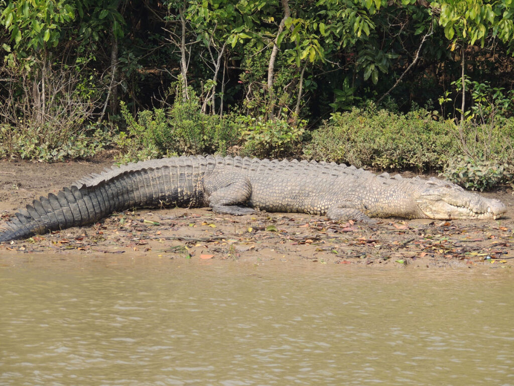
Saltwater Crocodiles
The park is especially known for housing one of the largest populations of saltwater crocodiles in India. Some crocodiles here grow up to 20 feet long, making them among the largest reptiles in the world.
Visitors often take boat safaris through creeks and rivers to spot these magnificent creatures basking on muddy banks or swimming in the water channels.
Other Animals in the Park
Apart from crocodiles, Bhitarkanika is home to:
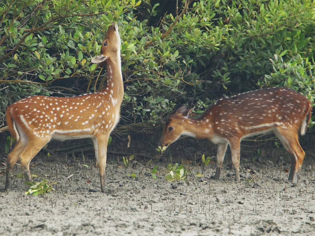
- Spotted deer
- Wild boars
- Fishing cats
- Monitor lizards
- Jackals
- King cobras and other reptiles
The park also supports several amphibians and aquatic species that thrive in its brackish water environment.
Birdwatching Paradise in Odisha
Bhitarkanika National Park is also a paradise for bird lovers and ornithologists. Every year, migratory birds travel thousands of kilometers to reach these wetlands.
Some commonly spotted birds include:
- Asian openbill stork
- Black ibis
- Brahminy kite
- Kingfishers
- Egrets and herons
- Migratory waterfowl
Birdwatching tourism has grown significantly in recent years, making Bhitarkanika an important destination for eco-tourism and wildlife photography.
Best Time to Visit Bhitarkanika National Park
The best time to visit Bhitarkanika is between October and March. During this period:
- The weather is pleasant
- Wildlife sightings are more frequent
- Migratory birds arrive
- Boat safaris operate smoothly
The park remains closed during the monsoon season due to heavy rainfall and flooding.
How to Reach Bhitarkanika National Park
Reaching Bhitarkanika requires a mix of road and boat travel, which makes the journey itself an adventure.
By Air
The nearest airport is Biju Patnaik International Airport in Bhubaneswar, around 160 km away.
By Rail
The nearest railway stations include:
- Bhadrak
- Cuttack
- Bhubaneswar
By Road
Travelers can reach the entry points such as:
- Khola Gate
- Gupti
- Chandabali
From these points, visitors take a boat ride through mangrove creeks to reach the park interior.
Boat Safari Experience
A boat safari is the best way to explore Bhitarkanika National Park. Unlike many other wildlife parks in India that offer jeep safaris, Bhitarkanika provides a water-based wildlife exploration experience.
During the safari, visitors can:
- Navigate through narrow mangrove canals
- Spot crocodiles and birds
- Observe dense mangrove forests
- Explore hidden creeks and islands
This unique travel experience makes Bhitarkanika one of the most memorable eco-tourism destinations in India.
Why Bhitarkanika is Important for Conservation
Bhitarkanika National Park is not just a tourist destination—it is also a vital conservation zone.
Key Ecological Importance
- Protects mangrove biodiversity
- Supports endangered wildlife species
- Maintains coastal ecological balance
- Acts as a buffer against natural disasters
- Supports fisheries and local livelihoods
The Ramsar designation also emphasizes the park’s global importance as a wetland ecosystem.
Conservation efforts here include:
- Crocodile breeding programs
- Mangrove restoration initiatives
- Wildlife monitoring
- Community-based eco-tourism
These efforts help preserve the fragile ecosystem for future generations.
Places to Visit Near Bhitarkanika
Visitors exploring Bhitarkanika often combine their trip with nearby attractions in Odisha.
Gahirmatha Marine Sanctuary
Known worldwide for Olive Ridley turtle nesting, this sanctuary hosts one of the largest sea turtle nesting sites on Earth.
Dangamal
Dangamal is the main tourism hub inside Bhitarkanika where forest lodges and watchtowers allow visitors to experience wildlife up close.
Habalikhati Beach
A remote and peaceful beach where visitors can enjoy untouched coastal landscapes.